
Anúncios
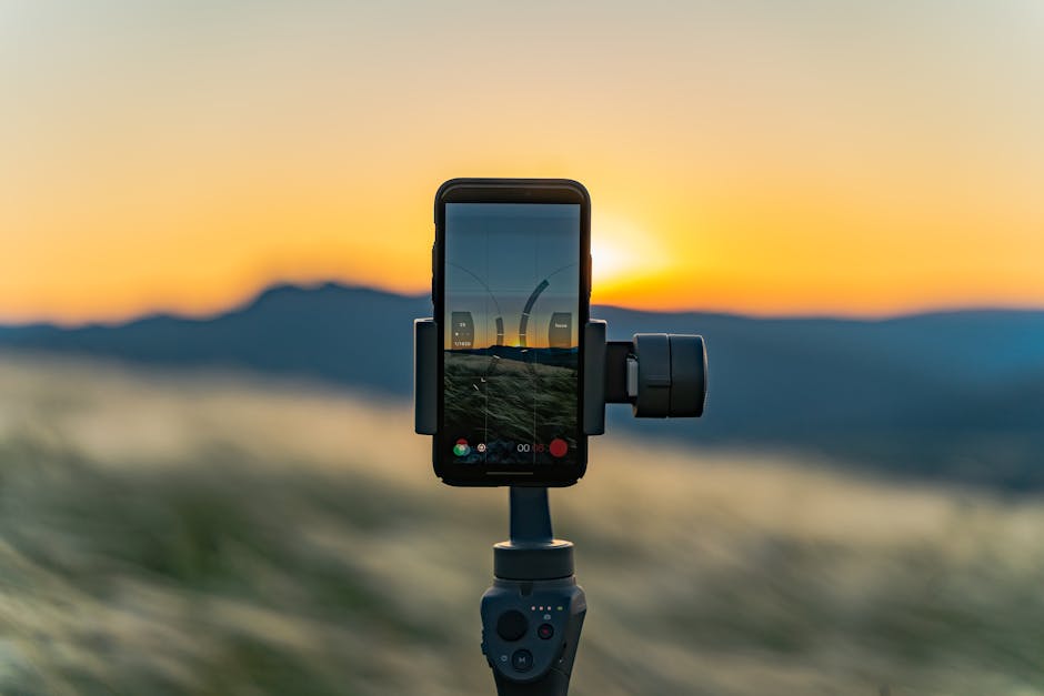
Measuring land accurately has never been easier thanks to modern mobile technology and specialized apps designed for property measurement and land surveying.
Whether you’re a farmer needing to calculate field dimensions, a real estate professional evaluating property boundaries, or a homeowner planning a landscaping project, land measurement apps have transformed how we approach spatial calculations.
Anúncios
These innovative tools leverage GPS technology and satellite imagery to deliver precise measurements right from your smartphone.
Gone are the days when measuring land required expensive equipment, professional surveyors, or complicated mathematical formulas.
Anúncios
Today’s measurement applications offer user-friendly interfaces combined with powerful algorithms that provide accuracy comparable to traditional surveying methods, all while fitting comfortably in your pocket.


📱 What Makes Land Measurement Apps Essential Tools?
The rise of land measurement applications represents a significant shift in how property professionals, agricultural workers, and everyday users approach spatial planning. These apps combine GPS positioning, mapping technologies, and computational power to create accessible solutions for what was once a specialized field.
Traditional land surveying involves physical equipment like measuring tapes, theodolites, and total stations—tools that require technical expertise and significant investment. Mobile applications democratize this process by utilizing the sensors already built into smartphones, particularly GPS receivers that communicate with satellite networks to determine precise locations.
The practical applications extend far beyond simple curiosity. Farmers use these tools to optimize crop planting and irrigation systems. Real estate agents rely on them for quick property assessments. Construction managers employ them for site planning. Even homeowners find value when designing gardens, installing fences, or calculating material requirements for outdoor projects.
🎯 Core Features That Define Quality Measurement Apps
Not all land measurement applications are created equal. The most effective tools share several key characteristics that separate them from basic mapping software.
GPS-Based Perimeter Tracking
The foundation of any quality measurement app is its ability to track your movement as you walk around a property’s perimeter. By recording GPS coordinates at regular intervals, the application creates a digital outline of the area. Advanced apps automatically calculate the enclosed space, providing instant area measurements in various units—square meters, acres, hectares, or square feet.
Map Integration and Satellite Imagery
Modern measurement tools integrate with mapping services to provide visual context. Users can view their measurements overlaid on satellite imagery or street maps, making it easier to identify boundaries, landmarks, and property features. This visual component proves invaluable when sharing information with clients, contractors, or team members.
Manual Pin Placement
Sometimes walking a property isn’t practical or possible. Quality apps allow users to manually place pins or markers on a map to define boundaries. This feature works especially well for remote properties, preliminary planning, or situations where physical access is restricted.
Distance Measurement Tools
Beyond area calculations, comprehensive apps include linear measurement functions. Users can measure distances between two points, calculate perimeters, and determine property dimensions along specific axes—essential information for fencing projects, roadway planning, or boundary verification.

🌾 Agricultural Applications: Transforming Farm Management
The agricultural sector has embraced land measurement technology with particular enthusiasm. Precision agriculture depends on accurate field measurements for everything from seed purchasing to yield calculations.
Farmers use these apps to divide large properties into manageable sections, each with recorded dimensions. This information feeds into crop rotation planning, fertilizer application calculations, and irrigation system design. When farmers know exactly how many acres require treatment, they can purchase materials more efficiently and reduce waste.
Harvest planning also benefits tremendously. By tracking field sizes and recording historical yield data, agricultural professionals can make better predictions about crop production, storage requirements, and market timing. The financial implications are significant—accurate measurements directly impact profitability by optimizing resource allocation.
🏡 Real Estate and Property Development Uses
Real estate professionals increasingly rely on measurement apps for quick property assessments during initial consultations and site visits. While these tools don’t replace official surveys required for legal transactions, they provide valuable preliminary information that helps agents and buyers make informed decisions.
Property developers use measurement applications during the early stages of project planning. Walking a potential site while recording its dimensions helps teams visualize development possibilities, estimate construction costs, and assess feasibility before committing to expensive professional surveys.
The ability to instantly share measurement data enhances communication between stakeholders. An agent can measure a property during a showing and immediately send the information to interested buyers. Developers can share site dimensions with architects and engineers within minutes of visiting a location.
🛠️ How to Use a Land Measurement App Effectively
Getting accurate results from measurement applications requires understanding both their capabilities and limitations. Following best practices ensures reliable data that you can confidently use for planning and decision-making.
Optimizing GPS Accuracy
GPS accuracy depends on several factors, including satellite visibility, atmospheric conditions, and device quality. For best results, conduct measurements in open areas with clear sky visibility. Buildings, dense tree cover, and steep terrain can interfere with satellite signals, reducing accuracy.
Many apps display current GPS accuracy, typically expressed in meters. Wait until your device achieves the best possible accuracy before beginning measurements. High-quality consumer GPS typically provides accuracy within 3-5 meters under good conditions.
Walking the Perimeter Correctly
When using GPS tracking mode, walk at a steady, moderate pace around the property boundary. Moving too quickly may cause the app to miss corners or create irregular shapes. Pause briefly at corners to ensure the app registers direction changes accurately.
Hold your device steady and avoid rapid movements that might confuse the GPS sensor. For large properties, consider marking boundary points with flags or markers before you begin to ensure you follow the correct path.
Calibrating and Adjusting Measurements
Most quality apps allow you to edit recorded boundaries by moving individual points. After completing a perimeter walk, review the shape on the map and adjust any points that don’t align with actual boundaries. This manual refinement improves accuracy, especially at corners or areas where GPS signals were temporarily weak.
📊 Comparing Digital Measurements with Professional Surveys
Understanding when mobile apps suffice and when professional surveying becomes necessary is crucial for making appropriate decisions.
| Aspect | Mobile App | Professional Survey |
|---|---|---|
| Accuracy | ±3-5 meters typical | ±0.01-0.1 meters |
| Cost | Free to $20 | $500-$3,000+ |
| Time Required | Minutes | Days to weeks |
| Legal Validity | Not recognized | Legally binding |
| Best For | Planning, estimates, general use | Property transactions, disputes, construction |
Mobile measurement apps excel at preliminary assessments, personal projects, and situations where approximate measurements suffice. They’re perfect for agricultural planning, landscaping design, fence installation estimates, and general property evaluation.
Professional surveys remain essential for property purchases, boundary disputes, construction permits, subdivision planning, and any situation with legal implications. The precision and legal recognition of professional surveys justify their cost in these contexts.
🌟 Advanced Features in Premium Measurement Apps
While basic measurement functionality meets many users’ needs, premium applications offer enhanced capabilities that provide additional value for professionals and frequent users.
Cloud Synchronization and Data Management
Advanced apps store measurements in cloud databases, enabling access across multiple devices and automatic backup protection. This feature proves essential for teams working collaboratively on multiple properties or projects requiring long-term data retention.
Export and Reporting Functions
Professional-grade apps generate detailed reports with measurement data, maps, and property information formatted for sharing with clients, contractors, or regulatory agencies. Export formats typically include PDF documents, KML files for use with other mapping software, and spreadsheet-compatible data files.
Multiple Measurement Layers
Some applications allow users to save multiple measurements on a single property, useful for tracking different sections, comparing development options, or monitoring changes over time. This layering capability transforms simple measurement tools into comprehensive property management systems.
Offline Functionality
Internet connectivity isn’t always available in rural areas or remote properties. Premium apps with offline map caching allow users to download map data in advance, ensuring full functionality even without cellular service. GPS positioning works independently of internet access, so measurements remain possible anywhere with satellite visibility.
💡 Tips for Choosing the Right Measurement App
The app market offers numerous options, each with different features, interfaces, and pricing models. Selecting the right tool depends on your specific needs and usage patterns.
- Assess your accuracy requirements: Casual users may find free apps sufficient, while professionals might benefit from premium tools with enhanced GPS processing
- Consider measurement types: Ensure the app supports both area and distance measurements if you need both capabilities
- Check unit options: Verify the app displays measurements in your preferred units, whether acres, hectares, square meters, or square feet
- Evaluate map sources: Quality satellite imagery and regularly updated maps improve usability significantly
- Test the interface: User-friendly design matters, especially when working outdoors in challenging conditions
- Review sharing capabilities: If you need to collaborate or share data, ensure the app supports your preferred communication methods
- Read user reviews: Real-world experiences from other users provide valuable insights into reliability and performance
🔧 Troubleshooting Common Measurement Issues
Even quality apps occasionally produce unexpected results. Understanding common issues and their solutions helps you maintain confidence in your measurements.
Inconsistent GPS Readings
If your measurements seem erratic or the GPS location jumps around, the device may be struggling to lock onto satellites. Move to an open area, ensure location services are fully enabled, and wait for the GPS accuracy indicator to improve before starting measurements.
Irregular Boundary Shapes
When perimeter tracking produces irregular or jagged boundaries, you likely moved too quickly or the GPS signal was weak. Retake the measurement at a slower pace, or use manual pin placement to create smooth, accurate boundaries.
Significant Area Discrepancies
If your measurement differs substantially from expected values, verify you’ve walked the correct boundary. Compare your recorded shape with satellite imagery to identify errors. Check that the app is displaying results in your intended units—confusing acres with hectares or square feet with square meters creates large apparent errors.
🌍 Environmental Considerations and Limitations
GPS-based measurement technology functions remarkably well under most conditions, but environmental factors can affect performance and accuracy.
Dense urban environments with tall buildings create “urban canyons” where GPS signals bounce off structures, causing multipath errors that reduce accuracy. Similarly, heavy forest canopy blocks satellite signals, making measurements less reliable.
Weather conditions generally don’t significantly impact GPS performance, though heavy cloud cover or severe storms may cause minor degradation. The GPS satellite network operates at frequencies that penetrate most atmospheric conditions effectively.
Magnetic interference from power lines, large metal structures, or electronic equipment can occasionally affect device sensors. If you suspect interference, move away from potential sources and allow the device to reacquire satellite signals before measuring.
📈 The Future of Mobile Land Measurement Technology
Emerging technologies promise to enhance measurement apps even further. Augmented reality features are beginning to appear, overlaying measurement data onto live camera views for intuitive visualization. This innovation helps users better understand spatial relationships and property features.
Improved GPS systems, including enhanced civilian access to military-grade signals and new satellite constellations, will increase accuracy to levels approaching professional surveying equipment. These advances may blur the distinction between consumer apps and professional tools.
Artificial intelligence integration could automatically identify property boundaries from satellite imagery, reducing or eliminating the need for manual perimeter walking. Machine learning algorithms might detect fences, hedges, roads, and other boundary markers, suggesting measurements for user confirmation.
Integration with drone technology represents another exciting frontier. Drones equipped with GPS and cameras can autonomously survey large properties, feeding data directly into measurement apps for processing—combining aerial perspective with computational power for unprecedented convenience and accuracy.
✅ Making the Most of Your Measurement App
Land measurement applications represent powerful tools that bring professional-grade capabilities to everyday users. Whether you’re managing farmland, evaluating real estate, planning construction projects, or simply curious about property dimensions, these apps provide accessible, affordable solutions.
Success with measurement technology comes from understanding both its strengths and limitations. Use these tools confidently for planning, estimates, and personal projects, while recognizing when professional surveying becomes necessary for legal or high-precision applications.
The technology continues evolving rapidly, with each generation of apps offering improved accuracy, enhanced features, and better user experiences. By embracing these tools today, you position yourself to benefit from ongoing innovations that make property measurement increasingly simple and reliable.
Download a quality measurement app, familiarize yourself with its features, and discover how mobile technology transforms the once-complex task of land measurement into something anyone can accomplish with confidence and accuracy. Your smartphone has become a powerful surveying instrument—learn to use it effectively and unlock new possibilities for property planning and management. 📏