
Anúncios
Earthquakes strike without warning, making real-time monitoring apps essential.
Tools for safety and preparedness in seismically active regions worldwide.
Anúncios
Living in earthquake-prone areas requires constant vigilance and preparedness.

Whether you reside in California, Japan, Chile, or any region along tectonic plate boundaries, having immediate access to seismic information can make the difference between safety and danger. Modern technology has transformed how we monitor and respond to earthquakes, placing powerful detection and alert systems directly into our pockets.
Anúncios
Smartphone applications dedicated to earthquake tracking have evolved dramatically over the past decade. These apps leverage data from geological surveys, seismograph networks, and even crowdsourced reports to deliver instant notifications about tremors occurring anywhere on the planet. Beyond simple alerts, today’s earthquake apps provide detailed magnitude information, epicenter locations, depth measurements, and potential tsunami warnings, empowering users to make informed decisions during critical moments.
📱 Why You Need an Earthquake Monitoring App
The unpredictable nature of seismic activity makes preparation the only viable defense strategy. Traditional emergency broadcast systems often deliver warnings too late, especially for earthquakes that strike with minimal precursor signals. Mobile applications bridge this critical gap by providing notifications within seconds of detection.
Real-time earthquake apps serve multiple essential purposes. They alert you to tremors you might not physically feel, particularly smaller magnitude events or those occurring at significant distances. These notifications help you distinguish between actual earthquakes and other vibrations, reducing unnecessary panic while ensuring you don’t dismiss genuine threats.
For travelers and international professionals, these apps become even more valuable. When visiting unfamiliar territories, you might not recognize local warning systems or understand regional emergency protocols. A reliable earthquake app delivers consistent, understandable information regardless of your location, helping you respond appropriately whether you’re in Tokyo, San Francisco, or Istanbul.
🌍 How Earthquake Detection Technology Works
Understanding the technology behind these applications enhances appreciation for their capabilities and limitations. Most earthquake tracking apps pull data from established seismological networks operated by government agencies like the United States Geological Survey (USGS), the European-Mediterranean Seismological Centre (EMSC), and national geological institutes worldwide.
These networks consist of thousands of seismographs strategically positioned across continents and ocean floors. When an earthquake occurs, seismic waves travel through the Earth’s crust, triggering these sensitive instruments. The data gets transmitted to central processing facilities where sophisticated algorithms calculate the event’s magnitude, depth, and precise location.
Modern apps incorporate P-wave detection technology, which identifies the faster-moving primary waves that precede the more destructive S-waves (secondary waves). This technique can provide precious seconds of warning before strong shaking begins, particularly for locations distant from the epicenter. While seconds might seem insignificant, they’re sufficient for automated systems to halt trains, shut off gas lines, and alert populations to take cover.
Crowdsourced Seismic Detection 📊
An innovative approach involves using smartphones themselves as rudimentary seismographs. Apps like MyShake and Earthquake Network utilize your device’s built-in accelerometer to detect ground motion. When multiple phones in a geographic area simultaneously register unusual vibrations, the app’s algorithm confirms an earthquake is occurring.
This crowdsourced method creates an incredibly dense detection network, particularly in urban areas where smartphone penetration is high. The system can identify earthquakes faster than traditional networks in regions lacking comprehensive seismograph coverage, making it especially valuable for developing nations with limited geological monitoring infrastructure.
🏆 Essential Features to Look For
Not all earthquake apps offer the same functionality. When selecting an application for serious safety purposes rather than casual interest, specific features distinguish truly useful tools from simple novelties.
Real-time push notifications represent the most critical feature. The app should deliver alerts within seconds of detection, with customizable settings allowing you to filter by magnitude, distance, and region. You don’t want notifications for every minor tremor globally, but you absolutely need immediate alerts for significant events near your location.
Comprehensive earthquake data should include magnitude, depth, exact time, precise coordinates, and distance from your current position. Historical data access lets you review past events, identify patterns, and understand your region’s seismic history. Interactive maps with multiple layers showing tectonic plates, fault lines, and recent activity provide valuable context.
Offline functionality becomes crucial during disasters when cellular networks might become overloaded or damaged. Quality apps cache recent earthquake data and essential information for access without internet connectivity.
Safety Resources and Educational Content 🎓
The best earthquake applications extend beyond simple monitoring to include educational resources about earthquake preparedness, safety procedures, and emergency planning. Look for apps offering:
- Detailed guides on creating emergency kits and evacuation plans
- Information about tsunami risks and coastal evacuation routes
- Checklist features for home earthquake preparedness
- Aftershock tracking and probability estimates
- Integration with emergency services and local alert systems
🔝 Top Earthquake Tracking Applications
Several excellent applications dominate the earthquake monitoring space, each with distinct advantages and specialized features catering to different user needs.
Earthquake Alert! by Josh Clemm
This application stands out for its user-friendly interface and reliable notification system. Drawing data primarily from the USGS, it offers customizable alert zones where you can define specific geographic areas for monitoring. The app displays earthquakes on an interactive map with detailed information cards for each event.
Users particularly appreciate the alert customization options, allowing granular control over which earthquakes trigger notifications based on magnitude thresholds and distance parameters. The app’s clean design makes information quickly accessible during stressful situations when clarity is paramount.
QuakeFeed Earthquake Alerts
QuakeFeed combines data from multiple international sources including USGS, EMSC, and GeoNet, providing truly global coverage. The application excels in its comprehensive filtering options and detailed statistical information about seismic activity.
Advanced users appreciate QuakeFeed’s technical depth, including spectral analysis, detailed waveform data, and probability calculations for aftershocks. The app also maintains an extensive historical database, allowing researchers and enthusiasts to analyze long-term seismic trends.
MyShake – Earthquake Early Warning
Developed by UC Berkeley’s Seismological Laboratory, MyShake pioneered smartphone-based seismic detection. Beyond providing alerts from traditional networks, the app turns your phone into a contributing sensor within a global earthquake detection network.
The application focuses particularly on early warning capabilities, delivering ShakeAlert warnings for locations covered by the system (currently California, Oregon, and Washington). The research-backed approach ensures scientific accuracy while contributing to seismological research with user-generated data.
Earthquake Network 🌐
This application pioneered crowdsourced earthquake detection, creating a global network of smartphones functioning as seismographs. The unique peer-to-peer approach sometimes provides faster alerts than traditional systems, especially in densely populated areas.
Earthquake Network includes social features allowing users to report their experiences, share damage photos, and communicate about local conditions. This community aspect provides valuable situational awareness beyond raw seismic data, helping people understand the real-world impact of events.
⚙️ Configuring Your Earthquake App Effectively
Simply installing an earthquake app provides minimal benefit without proper configuration. Optimizing settings ensures you receive relevant alerts without notification fatigue from insignificant events.
Start by defining your alert zones carefully. Most apps allow multiple monitoring regions – typically include your home location, workplace, and any areas where family members reside. Set appropriate magnitude thresholds for each zone; you might want notifications for any earthquake above 3.0 magnitude near home but only 5.0+ for distant regions.
Enable different notification styles for various severity levels. Critical alerts for major nearby earthquakes should use maximum volume and vibration, overriding silent mode. Lesser events might use subtle notifications that inform without alarming.
Battery Optimization Considerations 🔋
Earthquake apps running continuous background monitoring can impact battery life, particularly those using accelerometer-based detection. Most modern applications implement efficient algorithms minimizing power consumption, but proper phone settings ensure reliability.
Exempt your earthquake app from battery optimization features that might restrict background activity. Navigate to your phone’s battery settings and whitelist the application, ensuring it continues monitoring even during battery saver mode. This exemption becomes critical during emergencies when phone batteries might already be depleted.
🚨 Responding to Earthquake Alerts
Receiving an alert represents just the first step – knowing how to respond appropriately determines the actual safety benefit. Different alert types require different immediate actions.
For early warning alerts indicating imminent shaking, you have seconds to react. Immediately “Drop, Cover, and Hold On” – get low to the ground, take cover under sturdy furniture, and protect your head and neck. If outdoors, move away from buildings, trees, and power lines to an open area.
Alerts about distant earthquakes allow more measured responses. Check the magnitude and depth to assess tsunami risk if you’re in coastal areas. Magnitudes above 7.0 occurring under ocean floors warrant moving to higher ground immediately, without waiting for official tsunami warnings.
Post-Earthquake Safety Actions ✅
After shaking stops, your earthquake app continues providing valuable information. Check for aftershock predictions and remain alert – significant earthquakes often trigger numerous aftershocks, sometimes approaching the original event’s magnitude.

Use the app’s reporting features to document damage and share local conditions. This crowdsourced information helps emergency services prioritize response efforts and assists other community members in understanding the situation.
🧒 Earthquake Apps for Family Preparedness
Families living in earthquake-prone regions should integrate monitoring apps into comprehensive preparedness plans. Install the same application on all family members’ devices, ensuring consistent information and communication during emergencies.
Create shared alert zones covering each family member’s typical locations – schools, workplaces, and frequently visited areas. Establish communication protocols defining how the family will connect and reunite after significant earthquakes when regular communication might be disrupted.
Use the app’s educational resources to teach children about earthquake safety. Many applications include age-appropriate content explaining seismic activity, proper safety responses, and emergency preparedness in accessible language that reduces fear while building competence.
🔬 The Science Behind Earthquake Prediction Limitations
Despite technological advances, earthquake apps cannot predict earthquakes before they occur – they only detect and report events already in progress. Understanding this limitation prevents false security and encourages proper preparedness.
Earthquakes result from sudden stress releases along geological faults, processes occurring miles underground where direct observation remains impossible. While scientists identify high-risk regions and can calculate long-term probabilities, precise prediction of when specific earthquakes will strike remains beyond current scientific capabilities.
Some apps might display “earthquake forecasts” or probability calculations, but these represent statistical models based on historical patterns, not actual predictions. Treat such information as general risk awareness rather than actionable warnings.
🌊 Tsunami Warning Integration
Coastal residents need apps integrating tsunami warning capabilities with earthquake monitoring. Large submarine earthquakes can generate devastating tsunamis arriving within minutes to hours depending on distance from the epicenter.
Quality earthquake apps automatically assess tsunami risk based on magnitude, depth, and epicenter location. Earthquakes exceeding magnitude 7.0 with epicenters under ocean floors trigger immediate tsunami evaluation. Apps should provide clear guidance about evacuation routes and safe elevation levels.
Don’t wait for official tsunami warnings after feeling strong coastal earthquakes or receiving high-magnitude alerts – traditional warning systems might not respond quickly enough for near-source events. Immediately move inland and to higher ground, using your app to monitor ongoing developments and official advisories.
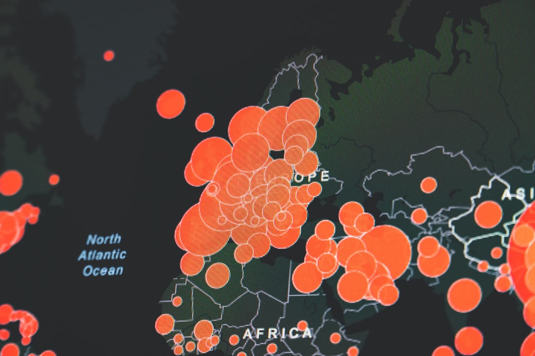
📈 Global Earthquake Activity Monitoring
Beyond personal safety, earthquake apps offer fascinating insights into our planet’s dynamic geology. Monitoring global seismic activity reveals Earth’s constant motion, with thousands of earthquakes occurring daily worldwide.
Most earthquakes remain too small or too deep to affect surface populations, but tracking this continuous activity illustrates tectonic plate interactions and volcanic system behaviors. Science enthusiasts and students can observe real-time geological processes, connecting classroom learning to actual planetary dynamics.
Interactive global maps displaying recent earthquake activity reveal clear patterns along plate boundaries – the Pacific Ring of Fire, the Mediterranean region, and the Himalayan mountain belt show concentrated seismic activity. Understanding these patterns helps contextualize local risks within broader geological frameworks.
🛠️ Future Developments in Earthquake Monitoring Technology
Earthquake detection and early warning systems continue evolving rapidly. Emerging technologies promise enhanced capabilities for the next generation of monitoring applications.
Machine learning algorithms are improving earthquake detection accuracy and reducing false alerts. These systems analyze subtle patterns in seismic data, distinguishing actual earthquakes from other ground vibrations more effectively than traditional methods.
Expanded smartphone-based detection networks will create unprecedented sensor density, particularly in urban areas. As more users participate in crowdsourced monitoring, the collective network’s sensitivity and coverage improve, potentially providing earlier warnings and more accurate event characterization.
Integration with smart home systems represents another frontier. Future apps might automatically trigger safety protocols when detecting earthquakes – shutting off gas lines, unlocking doors, and activating backup power systems without requiring human intervention.
💡 Making Earthquake Apps Part of Your Safety Routine
The most sophisticated earthquake app provides zero benefit if you don’t understand its features or check it regularly. Integrate the application into your normal routine rather than treating it as emergency-only software.
Check the app weekly to review recent seismic activity in your region. This regular engagement keeps you familiar with the interface and current earthquake patterns. Monthly reviews of safety resources and preparedness checklists ensure your emergency plans remain current and comprehensive.
Test notification settings periodically by temporarily lowering magnitude thresholds to ensure alerts function properly. Verify that sounds, vibrations, and visual notifications work as expected across different phone states – unlocked, locked, and silent mode.
Participate in annual earthquake preparedness drills, using your app to simulate scenarios and practice appropriate responses. Many regions hold “Great ShakeOut” events encouraging millions to simultaneously practice earthquake safety procedures – join these exercises to build muscle memory for actual emergencies.
🎯 Choosing the Right App for Your Needs
Selecting an earthquake monitoring application depends on your specific requirements, location, and technical comfort level. Casual users in low-risk areas might prefer simple, streamlined apps providing basic global monitoring without overwhelming detail.
Residents of high-risk seismic zones need comprehensive applications offering robust early warning systems, detailed technical data, and extensive safety resources. Consider apps specifically designed for your region if available – they often integrate local alert systems and regional emergency services more effectively than global alternatives.
Technical enthusiasts and professionals might prioritize apps providing detailed seismological data, waveform analysis, and research-grade information. These specialized applications offer depth that casual users don’t require but which proves invaluable for understanding earthquake mechanics and conducting amateur seismological studies.
Install multiple complementary apps rather than relying on a single source. Different applications use various data sources and detection methods, providing redundancy that ensures you receive alerts even if one system experiences delays or failures. This multi-app strategy offers the most reliable protection available through smartphone technology.
Earthquake monitoring apps represent powerful tools transforming smartphone devices into personal seismological stations and early warning systems. While they cannot prevent earthquakes or predict future events, they provide critical real-time information enabling informed decisions and appropriate responses during seismic emergencies. Combined with comprehensive preparedness planning, emergency supplies, and safety knowledge, these applications significantly enhance your ability to protect yourself and your family in earthquake-prone regions. Download a reputable earthquake app today, configure it properly, and make earthquake preparedness an integrated part of your safety routine rather than an afterthought following disasters.